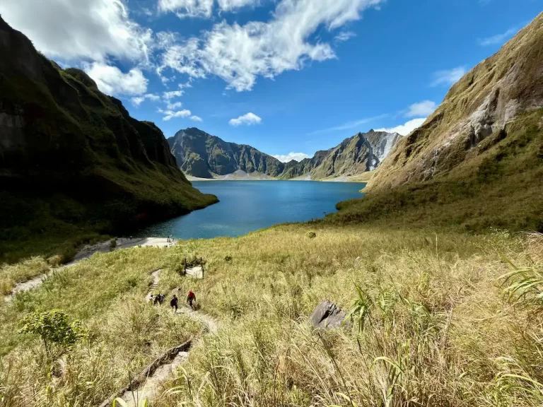
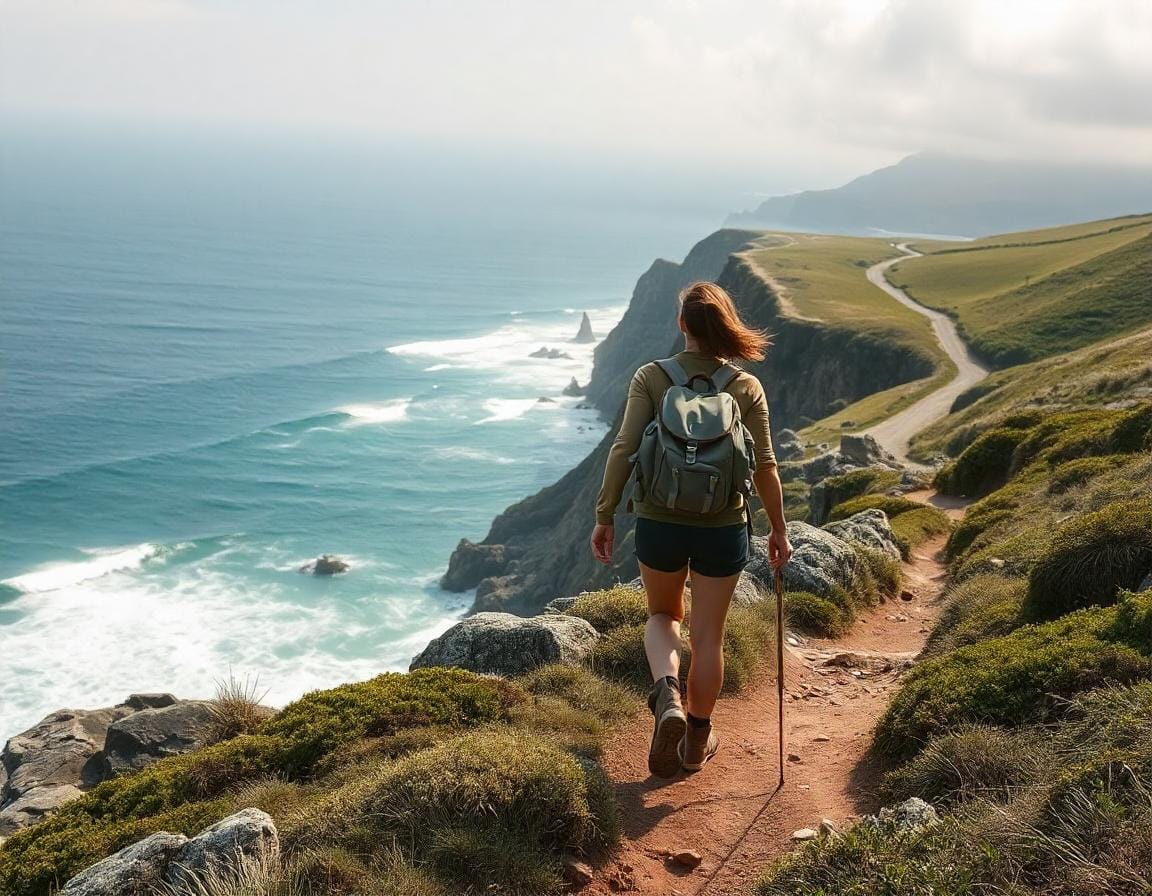
Salty air. Crashing waves. Endless ocean views.
That’s what you get on some of the best coastal hiking routes in the world. Whether you want a relaxing seaside walk or a rugged cliffside challenge, the 10 routes below can all be explored as day hikes.
For each hike, you’ll find the distance, difficulty, estimated hiking time, and best time to visit, along with practical tips to help you plan your day.
Before you set off, make sure you’re prepared. Having the 10 must-have day hike essentials can make your hike safer and more enjoyable.
From golden beaches to dramatic cliffs, here are 10 coastal hiking routes worth adding to your day-hike list.
Best Coastal Hiking Routes Around the World
1. Cinque Terre Sentiero Azzurro (Blue Path), Italy

| Distance | 7.5 miles (12 km) |
| Difficulty | Easy to moderate, depending on section |
| Duration | Varies by section |
| Best time to visit | Spring and early autumn |
The Cinque Terre Sentiero Azzurro, or Blue Path, is one of Italy’s most famous coastal hiking routes.
Running along the Ligurian coast, the trail network links the five colorful villages of Monterosso al Mare, Vernazza, Corniglia, Manarola, and Riomaggiore. Along the way, hikers are treated to Mediterranean views, terraced vineyards, olive groves, and steep cliffs above the sea.
However, the entire classic coastal route is not currently open as one continuous hike. The Corniglia–Manarola coastal section remains closed, although hikers can take an alternative route via Volastra. Trail conditions can also change because of weather or maintenance, so check the Cinque Terre National Park’s current trail status before setting out.
The famous Via dell’Amore between Riomaggiore and Manarola is open again. It is an easy, approximately 1 km paved section, but access is one-way from Riomaggiore and requires a Cinque Terre Card and a reserved time slot.
Rather than trying to cover every village on foot, you can choose the open sections that suit your fitness and available time and use the train to travel between villages.
Unique Features
UNESCO World Heritage site
Explore five coastal villages
Mix of paved paths and rugged terrain
Best For
Hikers seeking coastal villages, moderate trails, and Mediterranean views.
- Check the official trail status before your hike, as sections can close temporarily.
- A Cinque Terre Trekking Card provides access to the paid trails; the Train Card also includes regional train travel between the villages.
- Reserve a time slot if you plan to walk the Via dell’Amore.
- Wear suitable walking shoes and avoid the hottest part of the day during very warm weather.
2. Kalalau Trail (Hanakapi’ai Beach section), Kauai, Hawaii, USA
| Distance | 4 miles (6.4 km) round trip |
| Difficulty | Moderate to challenging |
| Duration | 3-4 hours |
| Best time to visit | May to October |
The Kalalau Trail is one of Hawaii’s most famous coastal hikes, but you don’t have to tackle the entire 11-mile trail to experience its spectacular scenery. The 4-mile round trip from Kēʻē Beach to Hanakāpīʻai Beach follows the first section of the trail along Kauai’s rugged Nāpali Coast, with views of the Pacific Ocean, lush valleys and dramatic sea cliffs.
The trail can be steep, muddy and slippery, particularly after rain, so good hiking shoes are essential. At the end of the two-mile hike, you’ll reach wild and remote Hanakāpīʻai Beach. Swimming and wading here are not recommended due to unpredictable waves and dangerous rip currents.
This shorter hike offers a taste of the Nāpali Coast’s rugged beauty without committing to the much more demanding full Kalalau Trail.
IMPORTANT: Advance reservations are required to enter Hāʻena State Park and access the Kalalau Trail. Check current access requirements and trail conditions before your visit.
Unique Features
Dramatic views of the Nāpali Coast
Lush tropical scenery
Remote Hanakāpīʻai Beach
Best For
Adventurous hikers seeking Nāpali Coast scenery without the full Kalalau Trail.
- Start early to avoid the midday heat
- Bring plenty of water and wear shoes with good traction
- Be prepared for sudden rain and changing trail conditions
3. Cliffs of Moher Coastal Walk, Ireland
| Distance | Up to 3.5 km (2.17 miles) round trip from the Cliffs of Moher Experience |
| Difficulty | Easy to moderate |
| Duration | Around 1–2 hours |
| Best time to visit | April to October |
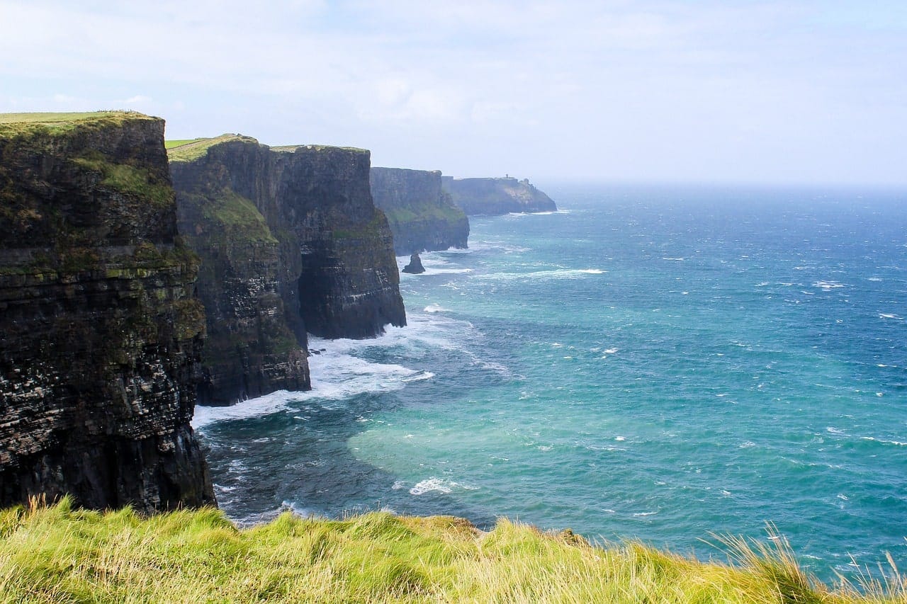
The Cliffs of Moher offer one of Ireland’s most spectacular coastal landscapes, with sheer cliffs rising dramatically above the Atlantic Ocean. At their highest point, the cliffs reach more than 700 feet (214 metres), with sweeping views towards the Aran Islands and Galway Bay on a clear day.
While the traditional coastal walk once connected Doolin and Liscannor, sections of the route are currently closed due to safety concerns. Visitors can still enjoy around 3.5 km (2.17 miles) of designated walking from the Cliffs of Moher Experience, including the route north past O’Brien’s Tower and viewpoints overlooking the cliffs to the south.
The weather here can change quickly, and strong winds are particularly important to watch for near the cliff edge. Stay on designated paths, obey barriers and check the current trail status before setting out.
Even without completing the original long-distance route, the combination of towering sea cliffs, Atlantic views and abundant birdlife makes the Cliffs of Moher one of Ireland’s most memorable coastal walks.
Unique Features
UNESCO Global Geopark
Sea cliffs rising more than 700 feet
Important seabird habitat, including puffins
Best For
Hikers seeking dramatic Atlantic views and an accessible coastal walk.
- Check the current coastal walk status status before visiting
- Stay on designated paths and respect all barriers and closures
- Check the weather forecast and avoid exposed areas during dangerous winds
4. Abel Tasman Coast Track (Anchorage to Bark Bay), New Zealand
| Distance | 7.1 miles (11.5 km) one way |
| Difficulty | Easy to moderate |
| Duration | Around 4 hours |
| Best time to visit | November to April |
The Abel Tasman Coast Track is one of New Zealand’s Great Walks, known for its golden beaches, turquoise waters and lush coastal forests.
The section from Anchorage to Bark Bay makes a beautiful one-way day hike. The 11.5 km (7.1-mile) all-tide route takes you through native coastal forest, across the 47-metre Falls River suspension bridge and past bays and tidal inlets before reaching the golden sands of Bark Bay.
The track is well formed, although there are some climbs along the way. At low tide, hikers can shorten the route by crossing the Torrent Bay Estuary, reducing the walk to 8.4 km (5.2 miles) and around three hours. An all-tide track around the estuary is available if the tide isn’t suitable for crossing.
With its combination of forest, beaches and sparkling coastal scenery, this section offers an excellent taste of the Abel Tasman Coast Track without committing to the full multi-day Great Walk.
Unique Features
Suspension bridge over Falls River
Golden beaches and tidal estuaries
Native coastal forest and birdlife
Best For
Hikers seeking an easy coastal hike with beaches and native forest.
- Check tide times if you plan to use the Torrent Bay Estuary shortcut
- Arrange water-taxi drop-off and pick-up in advance for a one-way hike
- Bring insect repellent, particularly during warmer months
5. Calanques National Park (Cassis to Calanque d’En Vau), France
| Distance | Around 5 miles (8 km) round trip |
| Difficulty | Moderate to challenging |
| Duration | 3-4 hours |
| Best time to visit | September to May |
The hike from Cassis to Calanque d’En Vau in Calanques National Park is one of the most picturesque coastal hikes in southern France.
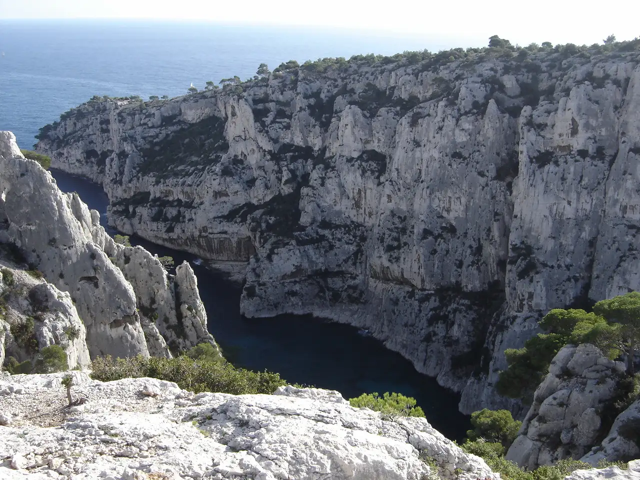
Starting from Cassis, the route leads towards Port-Miou and Port-Pin before continuing to En-Vau. Along the way, you’ll encounter rugged limestone landscapes, Mediterranean vegetation and beautiful views of the turquoise sea.
The trail becomes steep and rocky as you approach En-Vau, making sturdy footwear essential. At the bottom, the narrow inlet is surrounded by towering white limestone cliffs and a small pebble beach, where you can cool off in the clear Mediterranean water.
Despite its wild setting, En-Vau can become very crowded during summer. Visiting outside the peak summer months offers a better chance to enjoy the dramatic scenery with fewer people.
Unique Features
Dramatic white limestone cliffs
Clear turquoise Mediterranean waters
Three beautiful calanques along the route
Best For
Adventurous hikers seeking dramatic coastal scenery and a swim.
- Wear sturdy shoes as sections of the trail are steep and rocky
- Bring plenty of water and sun protection
- Check current park access before setting out, particularly from June to September when trails may close due to wildfire risk
6. Fira to Oia Hike, Santorini, Greece
| Distance | 6.5 miles (10.5 km) one-way |
| Difficulty | Moderate |
| Duration | 3-5 hours |
| Best time to visit | April to May & September to October |
The Fira to Oia hike on the island of Santorini is one of Greece’s most famous coastal walks, offering spectacular views of the Aegean Sea and Santorini’s volcanic caldera.
The 6.5-mile (10.5 km) one-way trail follows the caldera rim from Fira through Firostefani and Imerovigli before continuing towards Oia. Along the way, you’ll pass whitewashed villages, picturesque churches and countless viewpoints overlooking the sea.
The route combines paved village paths with dirt and rocky trails, with several climbs and descents along the way. There is also very little shade on the more exposed sections, making an early start particularly important during the warmer months.
The hike ends in Oia, where you can explore the village and its famous caldera views. With its combination of volcanic landscapes, traditional villages and sweeping sea views, this is one of the best ways to experience Santorini on foot.
Unique Features
Panoramic views of Santorini’s caldera
Whitewashed villages and blue-domed churches
Spectacular sunset views from Oia
Best For
Hikers seeking caldera views and picturesque Santorini villages.
- Start early to avoid the midday heat
- Wear sun protection and bring plenty of water
- Wear sturdy shoes for rocky and uneven sections
7. Great Ocean Walk (Princetown to Twelve Apostles), Australia
| Distance | 7 km (4.3 miles) one way |
| Difficulty | Easy to moderate |
| Duration | 2-3 hours |
| Best time to visit | September to November |
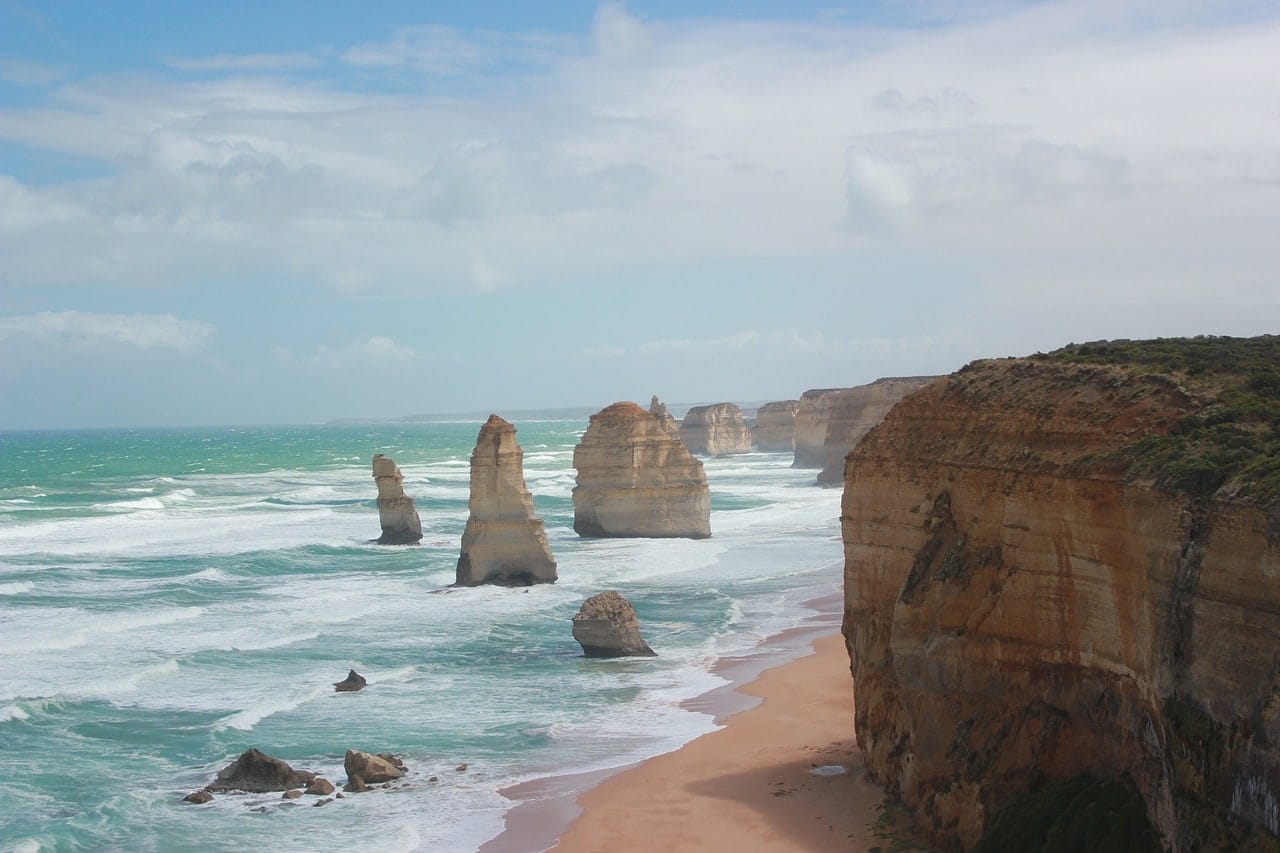
The final section of the Great Ocean Walk from Princetown to the Twelve Apostles offers spectacular views of Victoria’s rugged southern coastline without committing to the full multi-day trail.
The 7 km (4.3-mile) one-way hike takes you through coastal landscapes towards the towering limestone cliffs of Port Campbell National Park. As you approach the end of the walk, you’ll catch your first views of the famous Twelve Apostles rising from the Southern Ocean.
The trail finishes at the Twelve Apostles Visitor Centre, where you can continue to the viewing platforms for panoramic views of the limestone stacks and coastline.
This relatively short section is a great choice for hikers who want to experience one of the highlights of the Great Ocean Walk as a manageable day hike.
If you want to extend the hike, continue around 1.1 km along the Great Ocean Walk to Gibson Steps, where you can descend to the beach when conditions allow.
Unique Features
Iconic Twelve Apostles limestone stacks
Dramatic Southern Ocean cliffs
Coastal heathlands and panoramic ocean views
Best For
Hikers seeking iconic landmarks and dramatic coastal scenery.
- Arrange return transport in advance as this is a one-way hike
- Bring layers and waterproof clothing as coastal weather can change quickly
- Allow extra time to explore the Twelve Apostles viewing platforms
8. Robberg Nature Reserve – Point Circuit, South Africa
Dietmar Rabich / Wikimedia Commons / “Bosluiskop (ZA), Robberg Nature Reserve, Strand — 2024 — 2177-80” / CC BY-SA 4.0
| Distance | 5.7 miles (9.2 km) loop |
| Difficulty | Moderate to challenging |
| Duration | Around 4 hours |
| Best time to visit | March to May & September to November |
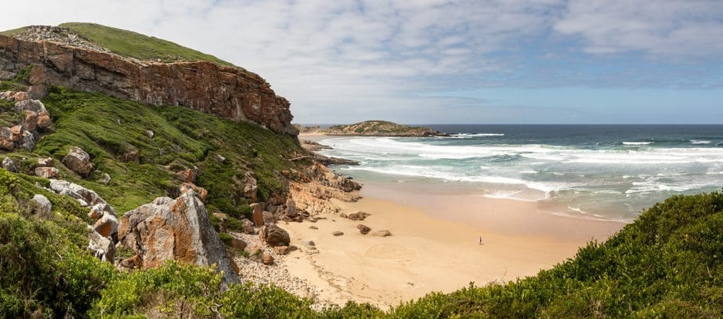
The Point Circuit in Robberg Nature Reserve is a spectacular coastal hike around the rugged Robberg Peninsula near Plettenberg Bay.
The 5.7-mile (9.2 km) loop follows the peninsula through a varied landscape of rocky cliffs, sandy beaches and coastal vegetation. Along the way, you’ll get sweeping views of the Indian Ocean and may see the large colony of Cape fur seals that lives along the peninsula.
The route continues towards the Point before returning along the southern side of the peninsula. Some sections involve steep climbs and rocky terrain, making this the most challenging of Robberg’s three hiking routes. You’ll also encounter the reserve’s huge sand dune and secluded stretches of coastline along the way.
Wildlife is another highlight, with seabirds commonly seen around the peninsula and southern right whales sometimes visible offshore during their migration season.
With its combination of cliffs, beaches, wildlife and dramatic ocean scenery, the Point Circuit is one of South Africa’s most rewarding coastal day hikes.
Unique Features
Large Cape fur seal colony
Dramatic cliffs, beaches and sand dunes
Chance to spot whales and seabirds
Best For
Adventurous hikers seeking wildlife and rugged coastal scenery.
- Wear sturdy hiking shoes for steep and rocky sections
- Bring plenty of water, sun protection and a windproof layer
- Check weather conditions before setting out and allow around four hours for the full circuit
9. Durdle Door to Lulworth Cove, England, UK
| Distance | Around 3 miles (5 km) round trip |
| Difficulty | Moderate |
| Duration | 2-3 hours |
| Best time to visit | May to September |
The hike between Durdle Door and Lulworth Cove is a short but spectacular section of England’s Jurassic Coast, offering dramatic cliffs, rolling hills and sweeping views across the English Channel.
The route follows the South West Coast Path between two of the area’s most famous landmarks. Durdle Door is a striking natural limestone arch formed by coastal erosion, while Lulworth Cove is known for its almost circular shape and distinctive geology.
Despite the relatively short distance, expect some steep climbs and descents along the way. You can also descend to the beach at Durdle Door before continuing along the coast, adding another perspective of the famous rock formation.
This is an excellent coastal hike for anyone who wants to experience some of the Jurassic Coast’s most recognizable scenery without committing to a long-distance walk.
Unique Features
UNESCO World Heritage site
Iconic natural limestone arch
Diverse coastal geology spanning 185 million years
Best For
Hikers seeking iconic landmarks and a short, scenic coastal walk.
- Wear sturdy shoes for the steep and uneven sections
- Keep well back from cliff edges and follow marked paths
- Allow extra time to explore Durdle Door beach, Lulworth Cove and nearby Stair Hole
10. Tomales Point Trail, Point Reyes National Seashore, California, USA
| Distance | 9.5 miles (15 km) round trip |
| Difficulty | Moderate to challenging |
| Duration | 4-6 hours |
| Best time to visit | March to October |
The Tomales Point Trail in Point Reyes National Seashore offers a spectacular coastal hike with sweeping views of the Pacific Ocean.
The 9.5-mile (15 km) round trip follows an open ridgeline along the peninsula, with panoramic views of Tomales Bay, Bodega Bay and the rugged Pacific coastline. The trail also passes through the Tule Elk Reserve, making this one of the best places in Point Reyes to see tule elk in their natural surroundings.
While the first three miles are maintained, the final section towards Tomales Point is unmaintained, sandy and sometimes overgrown. The distance and exposed conditions make the full hike more challenging than the relatively gentle terrain might suggest.
At Tomales Point, dramatic coastal bluffs overlook the Pacific Ocean. Stay on the main trail and well back from cliff edges, as sections of the bluffs are unstable and prone to collapse.
With its combination of wildlife, wildflowers and expansive ocean views, Tomales Point is one of California’s most rewarding coastal day hikes.
Unique Features
Tule Elk Reserve
Dramatic coastal cliffs
Wildflower displays in spring
Best For
Nature lovers seeking wildlife and sweeping coastal views.
- Bring plenty of water as there are no potable water sources at Tomales Point
- Wear long pants and sleeves for the overgrown final section
- Be prepared for fog, strong winds and changing coastal conditions
- Stay on the main trail and well back from unstable cliff edges
What Makes a Coastal Day Hike Great
Coastal day hikes offer a unique combination of natural beauty, physical challenge, and sensory experiences. Here are the key elements that elevate a coastal hiking route from good to truly great:
Scenic Beauty
Great coastal hikes showcase stunning views of shorelines, seas, and surrounding landscapes. Think dramatic cliffs, pristine beaches, and sweeping ocean vistas that take your breath away.
Diverse Landscapes
The best hikes often feature a variety of terrains and ecosystems. You might transition from sandy beaches to rocky cliffs, or from coastal forests to open bluffs, keeping the journey interesting at every turn.
Unique Natural Features
Distinctive elements like sea arches, hidden coves, tidal pools, or unusual geological formations add a sense of discovery and wonder to the hike.
Wildlife and Flora
Opportunities to observe coastal wildlife and unique plant species can transform a hike into a memorable nature experience.
Cultural or Historical Significance
Some of the finest coastal hikes offer glimpses into local culture or history, such as lighthouses, fishing villages, or ancient ruins, adding depth to your journey.
Accessibility and Trail Quality
While a challenge can be rewarding, great day hikes should be accessible to reasonably fit hikers and feature well-maintained trails for a enjoyable experience.
Safety
The best trails allow hikers to experience nature’s beauty while remaining safe with proper precautions, considering factors like tides, cliff edges, and weather conditions.
Sensory Experience
A truly great coastal hike engages all the senses – from the sound of crashing waves to the smell of sea air, creating a fully immersive experience.
Photogenic Quality
Great coastal hikes offer plenty of opportunities to capture and share breathtaking views and memories.
Solitude or Social Experience
Depending on personal preference, some hikers may value the serenity of a less-traveled path, while others might enjoy a more popular trail with a sense of community.
These factors were considered in curating the list of the 10 best coastal day hikes in the world. Each trail offers a unique and memorable experience, promising outdoor enthusiasts and nature lovers an adventure they won’t soon forget.
Safety Tips for Coastal Hiking
Safety should always be a top priority when heading out on a coastal hike. To ensure a safe and enjoyable experience, consider the following tips:
Check the Weather
Coastal weather can change rapidly. Be prepared for wind, fog, or sudden rain by checking the forecast on a reliable source like Weather.com
Know the Tides
Some trails may cross beaches or rocky areas that are inaccessible at high tide. Plan your hike around the tide schedule to avoid getting stranded.
Wear Proper Footwear
Coastal paths can be uneven, slippery, and rocky. Sturdy hiking shoes with good grip will help keep you steady on tricky terrain.
Stay Hydrated and Pack Snacks
Coastal hikes, especially in exposed areas, can be draining. Carry plenty of water and energy-boosting snacks to stay fueled along the way.
Bring a Map or GPS
Coastal weather can change rapidly. Be prepared for wind, fog, or sudden rain by checking the forecast before setting out.
Watch for Wildlife
Coastal regions are often home to unique wildlife. Admire from a distance, and always follow local guidelines to protect both yourself and the animals.
Which Coastal Hike Will You Tackle First?
There’s nothing quite like a coastal day hike—the fresh ocean air, dramatic cliffs, and endless sea views make every step unforgettable.
Whether you’re tackling Hawaii’s rugged cliffs or strolling England’s scenic shores, these hikes offer adventure, beauty, and memories to last a lifetime.
From New Zealand’s turquoise waters to California’s wild coastline, these trails prove that the best way to experience the ocean is on foot. Which one will you explore next?
FAQs
1. What is the best coastal hiking route for beginners?
The Abel Tasman Coast Track in New Zealand is a great choice for beginners. It offers well-maintained trails, stunning ocean views, and manageable elevation changes. Plus, you can break the hike into shorter sections and even take water taxis between points.
2. What should I bring on a coastal day hike?
You should always bring:
- Plenty of water
- Sunscreen and a hat for sun protection
- Sturdy hiking shoes with good grip
- A lightweight rain jacket in case of unexpected weather
- A map or GPS device for navigation
For a complete checklist, check out 10 Must-Have Day Hike Essentials.
3. Are coastal hiking trails safe?
Yes, but it’s important to be prepared. Watch out for:
- Unstable cliffs and loose rocks
- Changing tides that can block paths (especially in places like Kalalau Trail)
- Sudden weather changes—always check the forecast before heading out
Staying on marked trails and carrying the right gear will keep you safe.
4. When is the best time to go on a coastal hike?
It depends on the location!
- For warm-weather destinations (Hawaii, Australia, New Zealand), spring and fall offer cooler temperatures and fewer crowds.
- For cooler climates (Ireland, Iceland, Canada), summer is the best time to avoid extreme cold and rain.
5. Can I hike coastal trails year-round?
Some coastal trails are accessible year-round, but weather conditions vary:
- Tropical regions (Hawaii, South Africa) are great all year, but summer can be hot and humid.
- Northern locations (Canada, Iceland) may be snow-covered in winter, making some trails dangerous or inaccessible.
Always check seasonal trail conditions before planning your hike.